■ver. 3.30.0
・You can now search for routes that everyone has published on the app.
■ ver. 3.29.1
・ Minor fixes.
■ ver. 3.29.0
・National general toll roads・When creating a route
, it is now possible to specify a priority road for each transit area.
■ ver. 3.28.0
・Added minor support.
■ ver. 3.27.1
・Minor bugs have been fixed.
■ ver. 3.27.0
・You can now display your running speed on the map during navigation. When the maximum speed is exceeded, the display turns red and a voice guides you. Speed limit guidance can be changed in the settings.
■ ver. 3.27.0
・You can now display your running speed on the map during navigation. When the maximum speed is exceeded, the display turns red and a voice guides you. Speed limit guidance can be changed in the settings.
■ ver. 3.26.0
・The current time can now be displayed on the map during navigation.
■ ver. 3.22.0
・Android Auto is now supported!
- Destination search and navigation can now be performed on in-vehicle devices equipped with Android Auto. Please use all means.
■ ver. 3.22.1
・Minor corrections were made.
■ ver. 3.20.0
・Minor fixes.
■ ver. 3.18.0
・If ETC usage is turned off in the route search conditions, routes that avoid ETC-only toll gates will be displayed. Also, the ETC dedicated toll gate icon is displayed on the map.
.
Now! You can change the stopover skip setting in the navigation category of the setting screen, so please try it.
■ ver. 3.14.2
・ Fixed some bugs.
■ ver. 3.12.0
・ The distance to the destination and the arrival time display on the navigation screen can now be switched to the information to the nearest stopover.
■ Ver. 3.11.0
when riding in the tunnel, now automatically at night to switch to the map.
■ ver. 3.10.0
・
■ ver. 3.29.0
・Compatible with motorcycle tolls on general toll roads nationwide
・When creating a route, it is now possible to specify priority roads for each transit area
■ ver. 3.8.0
・ Several new 3D landmarks have been added on the map.
■ ver. 3.6.1
・ Fixed the problem of forced termination when displaying a map of some areas
. ■ ver. 3.6.0
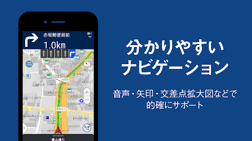
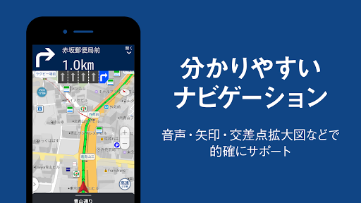
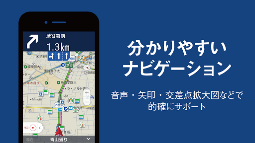
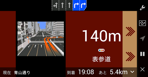
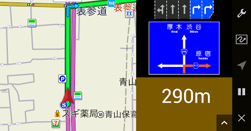
・ Improved the navigation screen to make it easier to see.
――You can now select the size of the guide image from large, small, and OFF.
――You can now see the lane information of the latest passing intersection.
--Reviewed the expansion rate and timing of the automatic intersection expansion function.
■ ver. 3.5.0
・ It is now possible to provide voice guidance for sharp curves during navigation.
■ ver . 3.4.0
・ It is now possible to lock the screen display direction during navigation! You can set from "Fixed vertically", "Fixed horizontally", and "Fit to terminal settings".
-It is now possible to display smooth lines in addition to displaying congestion lines on the map. You can set it from the map layer setting screen.
-Added the function to draw the newly opened road on the map on the same day.
■ ver. 3.3.0
・ Added a mode to reduce the amount of communication by using offline data.
* This function is limited to the Premium Plus course.
■ ver. 3.2.0
・ You can now customize the spot icon displayed on the map!
You can set it from the setting screen of the application.
■ ver. 3.1.0
・ You can now customize the content of the voice guidance!
You can set it from the setting screen of the application.
■ ver. 3.0.0
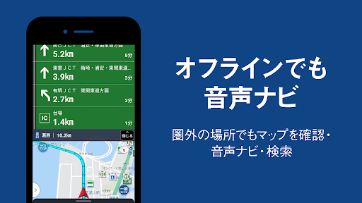
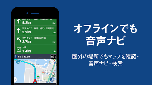
・ Offline function has been added!
――Maps, voice navigation, and point search are now available even outside the service area! Please use it for safe and secure touring even in places where communication is not possible, such as mountain roads and roads along the sea.
* This is a function limited to the Premium Plus course. * Click here for the functions
currently available in the Premium Plus course-
Offline function-
The maximum number of route saves is 50 (20 for the premium course)
■ ver. The following
functions have been added on the 2.53.0 navigation screen.
-It is now possible to display the pause point on the map and speak.
-The maximum speed of the road you are currently driving is now displayed on the screen.
Please use it for safe touring!
■ ver. 2.52.0
・ If there is a building that serves as a landmark at an intersection in the navigation, the landmark building is voiced. Added functions to guide you-
Fixed the UI of the top screen-
Added other minor fixes
■ ver. 2.51.0
・ If there is a landmark building at the intersection in the navigation, change it to guide the landmark building
・ Add the navigation volume adjustment setting to the navigation setting screen
・ Members during mass touring Fixed
■ ver. 2.50.0
・ Added American type and naked type to the current location icon
■ ver. 2.49.2
・Fixed the problem that the image of the touring road could not be displayed.
-Some screens have been improved.
■ ver. 2.49.1
・Fixed the problem that biography image cannot be selected.
-Some screens have been improved.
■ ver. 2.48.1
・Fixed a bug on the navigation screen.
■ ver. 2.48.0
・ My point and home are now displayed as icons on the map!
Click the icon to add it to the route point!
You can switch between showing and hiding by selecting [Settings] ⇒ [Map] ⇒ [My Point Icon].
Please use it for the coming touring season.
■ ver. 2.47.0
-A fast and easy-to-read "guide mode" has been added to the navigation screen!
When you enter the highway, it will switch automatically, and you can also switch manually.
Please use it for the coming touring season.
■ ver. 2.46.0
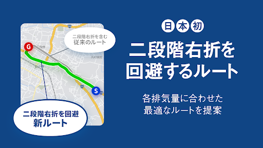
・ Supported to call attention at the sign points where two-step right turn / two-step right turn is prohibited.
* As of February 2020, only available in Nagasaki Prefecture
*
■ ver. 2.44.0
-It is now possible to switch the current road between highways and general roads during navigation.
Replace new units " to the schedule ■ ver. 2.43.0
・ You can now change the name of the My Point folder!
Please use it to organize your favorite spots.
■ ver. 2.41.0 The
service area / parking area icon is now displayed on the route on the route search result screen.
Also, by tapping the icon, detailed information of the facility and estimated arrival time will be displayed.
■ ver. 2.40.1
・ You can now easily specify points on the map to search for routes.
Please use from "Create route" → "Set point" → "Search from map".
Also, you can now specify the location by tapping the map on other screens.
■ ver. 2.39.1
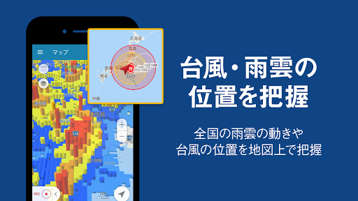
・ "Typhoon" has been added to the map layer settings.
You can display the expected course of the typhoon on the map.
Please help us when planning your touring.
■ ver. 2.39.0
・ Fixed the malfunction that occurred in android 10.
■ ver. 2.38.0
・ It is now possible to automatically change to an appropriate route and guide you according to real-time traffic conditions.
You can use it by turning on "Real-time auto reroute" from the settings.
■ ver. 2.36.0
We have introduced an auto-completion feature for point search.
When you enter characters, the results will be displayed in real time.
■ ver. 2.35.0 Some changes in the operation specifications.
■ ver. 2.34.2
In some versions of the app, there is an event that the tooling road is not displayed on the map.
Please use the app after updating it to the latest version (ver.2.34.2).
We apologize for any inconvenience this time.
■ v 2.3 2.0
・ Motorized type has been added to the selectable current location icon.
■ v 2.31.0
· The created route can now be saved.
■ v 2.30.0
· The gasoline price display on the map can now be selected from regular high octane.
■ v 2.27.0 Minor improvements were made.
■ v 2.26.0 It corresponds to the toll road rate display of the moped.
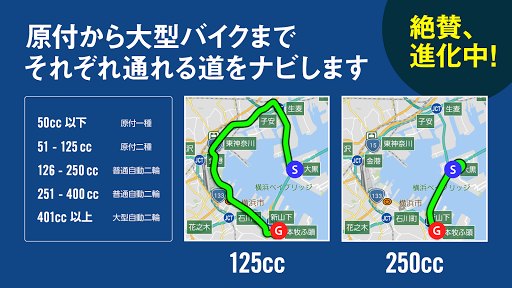
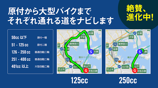
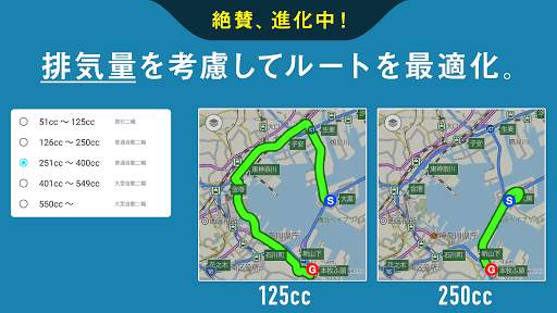
By setting in-app setting - displacement amount considering the displacement amount of 125 cc or less, the charge of the toll road displayed in the route result will be displayed as the charge of the mandatory classification.
■ v 2.25.1 Fixed the bug.
■ v 2.25.0 Adjustment of the navigation operation was done.
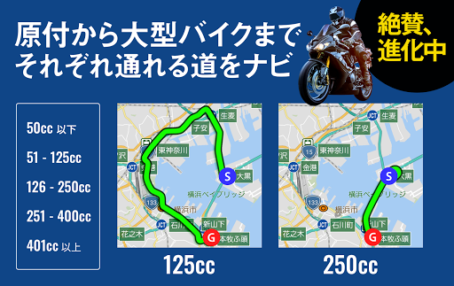
■ v 2.23.0 Now you can display the route of the first type (50cc or less) of the original type. Please use on the setting from the displacement setting screen.
■ v 2.22.0
Category search results can now be checked on the map. You can switch from the top right icon of the list screen.
■ v 2.21.0 Added the function to customize the location icon! You can choose your favorite icon from all seven icons (default + 6 bikes).
■ v 2.20.0 When the traffic regulation information is different from the actual, I added a posting function so that you can point out. We will continue to improve our services, so we appreciate your cooperation.
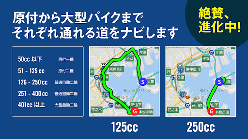
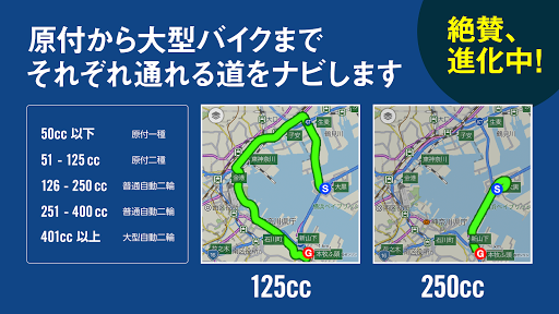
■ Route search with consideration of v 2.19.0 displacement became possible! - I will show you the route according to the displacement of your bike. - We also corresponded to routes that can pass two varieties.
■ v2.18.0 High speed recommended lane guidance and railroad crossing guidance function added! It became possible to guide the existence of lanes and railroad crossing which should enter before branching on the expressway by voice.
■ 2.17.2 A minor bug was fixed.
(Updated on 7/26) ■ Moto SmaCon (smart remote control for bike), now the navigation mode can now be changed. (Updated on 6/28) ■ Background navigation function was added Even when closing the application during navigation, voice guidance is now uttered without stopping. Please use all means. (Updated 6/6) ■ Moto SmaCon (smart remote control for bike) began cooperation You can move the map, enlarge / reduce, and speak the next voice guidance during navigation. Please use it for touring.
(Updated 6/6) ■ Moto SmaCon (smart remote control for bike) began cooperation You can move the map, enlarge / reduce, and speak the next voice guidance during navigation. Please use it for touring. (Updated on 3/15) ■ Strengthen navigation outside the communication area Even if it became outside the communication area in the mountain area etc, the map under guidance can be seen continuously! ■ Fixed some minor bugs. (Updated on 2/14) ■ It corresponds to the photo enlargement of BikeJIN course details screen. (1/31 update) ■ It corresponded to snowfall / snow cover! You can display from the map setting button on the left of the map screen. - A minor bug was fixed. (1/17 update) ■ Minor corrections were made. (Updated on December 20) ■ Sunrise sunset correspondence Sunrise / sunset date and time are now displayed on the spot detail screen and the route search result screen.
■ v 2.21.0 Added the function to customize the location icon! You can choose your favorite icon from all seven icons (default + 6 bikes).
 adcom KitKat A35

